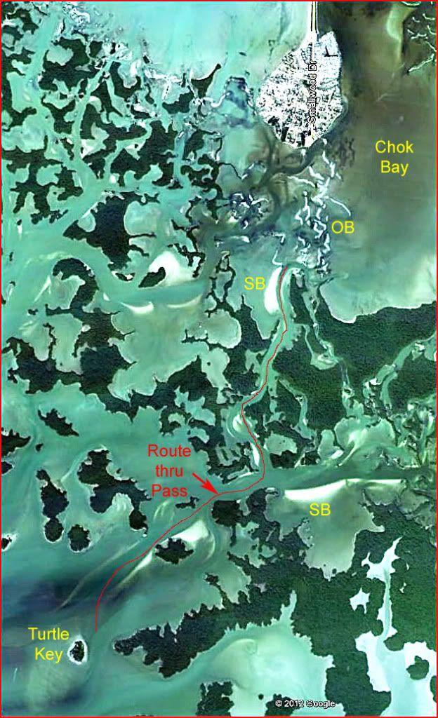
Navigating Chokoloskee to Pavilion KeyThe problem for the new visitor to the Ten Thousand Islands area of the Everglades is that there are no landmarks. As the expression goes, “Everything looks the same!” Probably there are only a few hundred islands rather than 10,000; but that may not be much consolation.
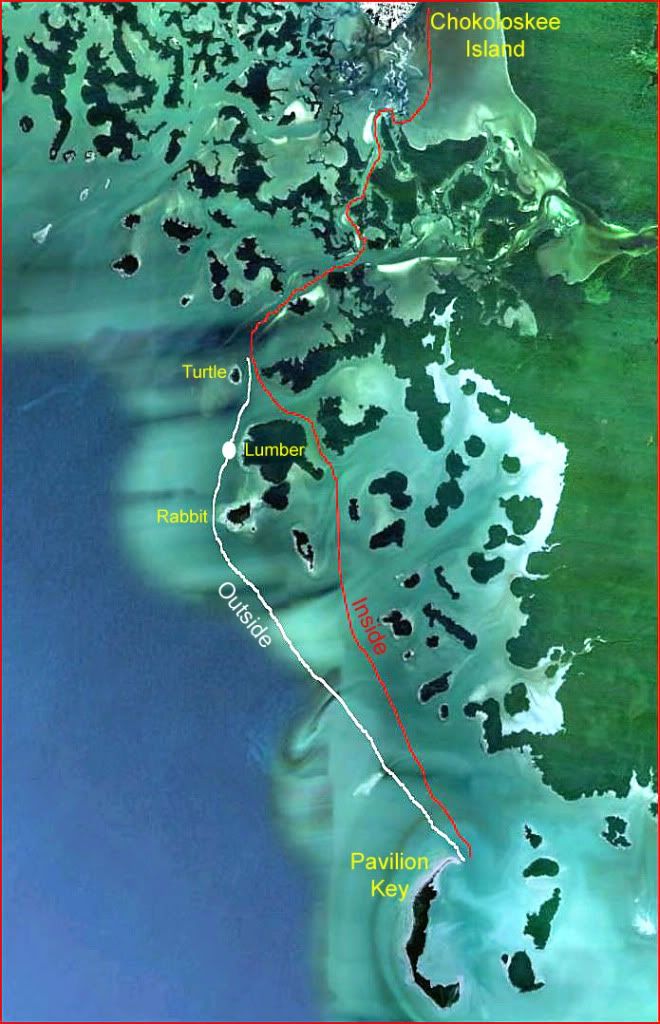
This Google image shows the terrain that must be navigated when making a trip from Chokoloskee Island to Pavilion Key (Lat 25.699760 deg, Lon -81.353978 deg.) This is about 25% of the Ten Thousand Islands area.
 This is my route from Chok to PAV.
 At Turtle Key on our way to PAV, we can go on the inside route (red) to partially avoid rough water on the Gulf. This is also the route we take if we want to do some fishing. We take the outside route (white) to pick up more wind.
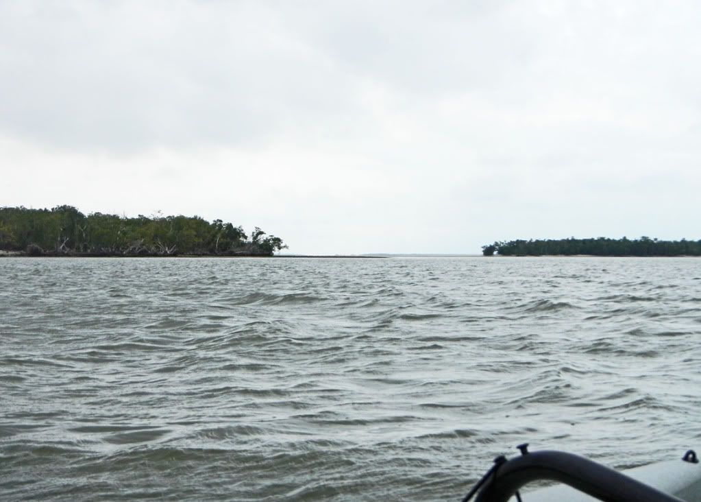
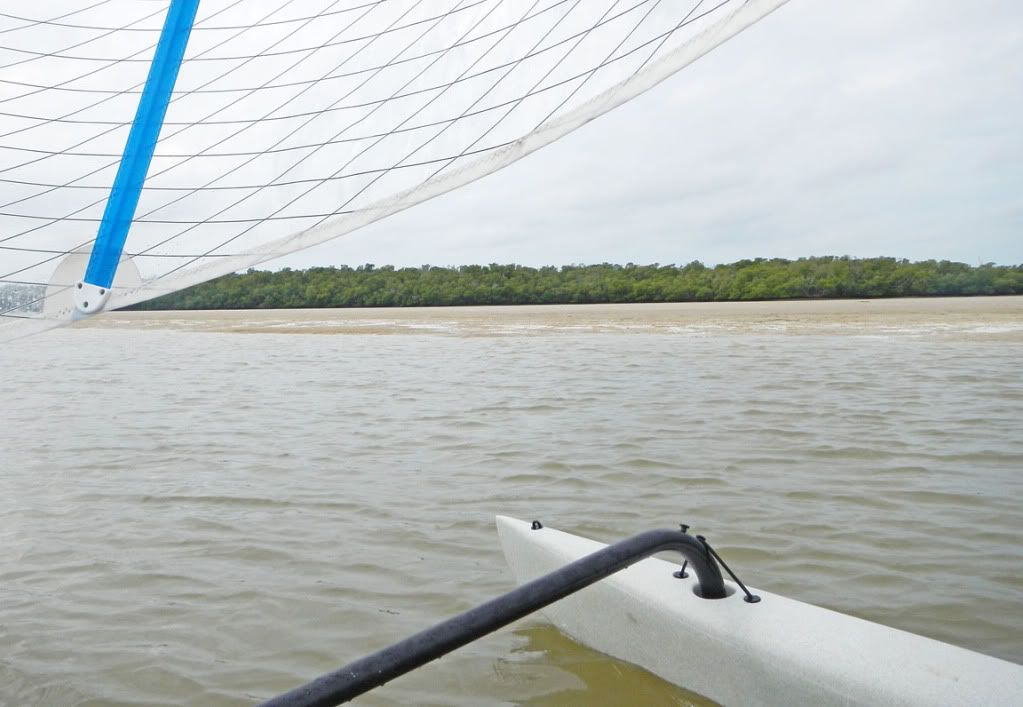
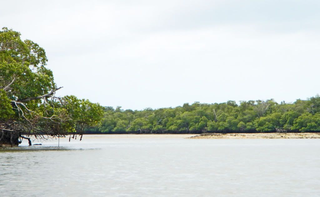
 This is a view on the outside route just after leaving Turtle Key (see dot on previous image for location.)
 It is the view directly at PAV with Lumber on the left and Rabbit on the right. PAV is about 4.5 mi (7 km) distant. You cannot go between Lumber and Rabbit because there is a serious sand/gravel bar connecting them. In recent years, that barrier has been building. A hurricane in the area could wipe it away overnight, or build it a yard (meter) or 2 higher.
The
“pass” through the islands runs from the oyster bars in Chok Bay to Turtle Key, about 3 mi (5 km).
Following are a few pictures in the pass.
Here is a sand bank. I’m travelling in a channel next to the SB. At “high tide” this SB is 6” to 12” (14-25 cm) under water.
 The dot shows where the previous picture was taken.
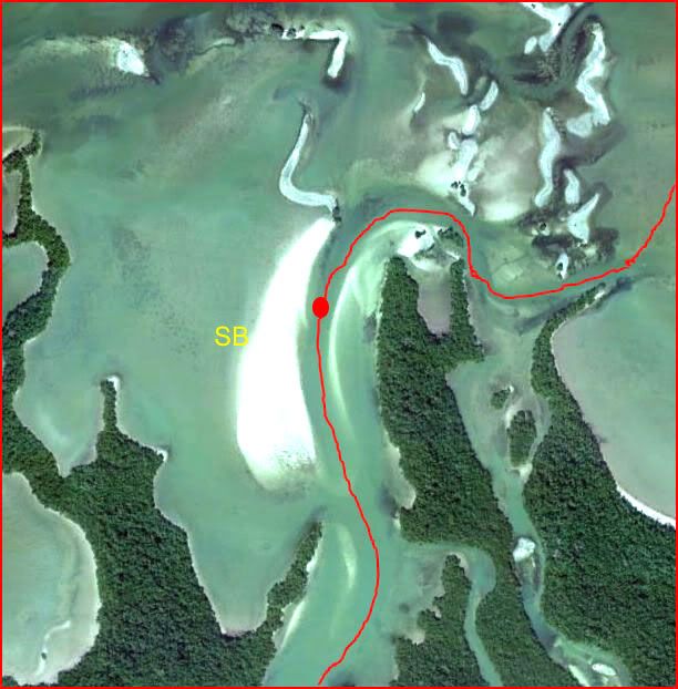 This shows one of the many small passages along the main “pass” route.
 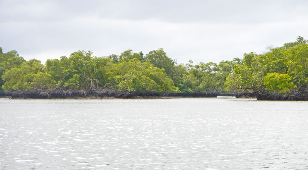 This is a typical view in the pass.
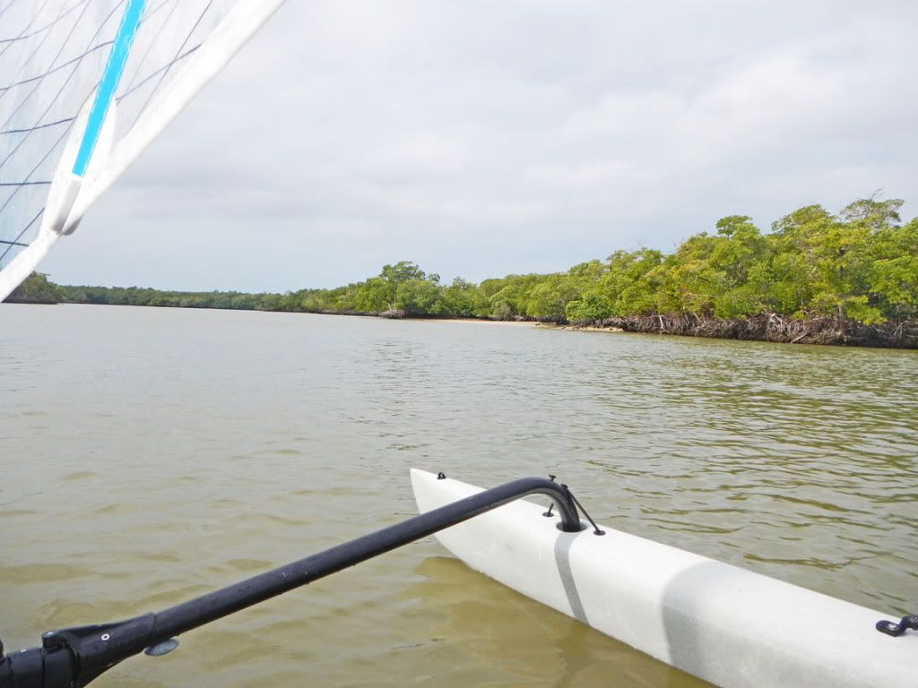 Here, the pass makes a sharp left.
 It is quite wide at this turn (about 150 yds), but currents are such that an oyster bar is developing in the middle. A few weeks ago as we moved through this area, we found a hapless power boater stuck high and dry on this OB—and the tide was still falling! He would be there for several hours waiting for the tide to come in to float his boat. He might wait more, 12 hrs more, if the next high tide is insufficient to float his boat.
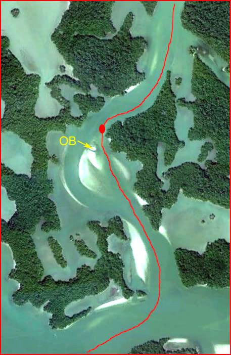
 The dot on the Google image shows where the picture was taken.
 The main channel runs on the other side of this bar. Most power boaters use that channel. To avoid the high-speed power boaters, I make a sharp left turn before the bar and run along the mangroves on the left.
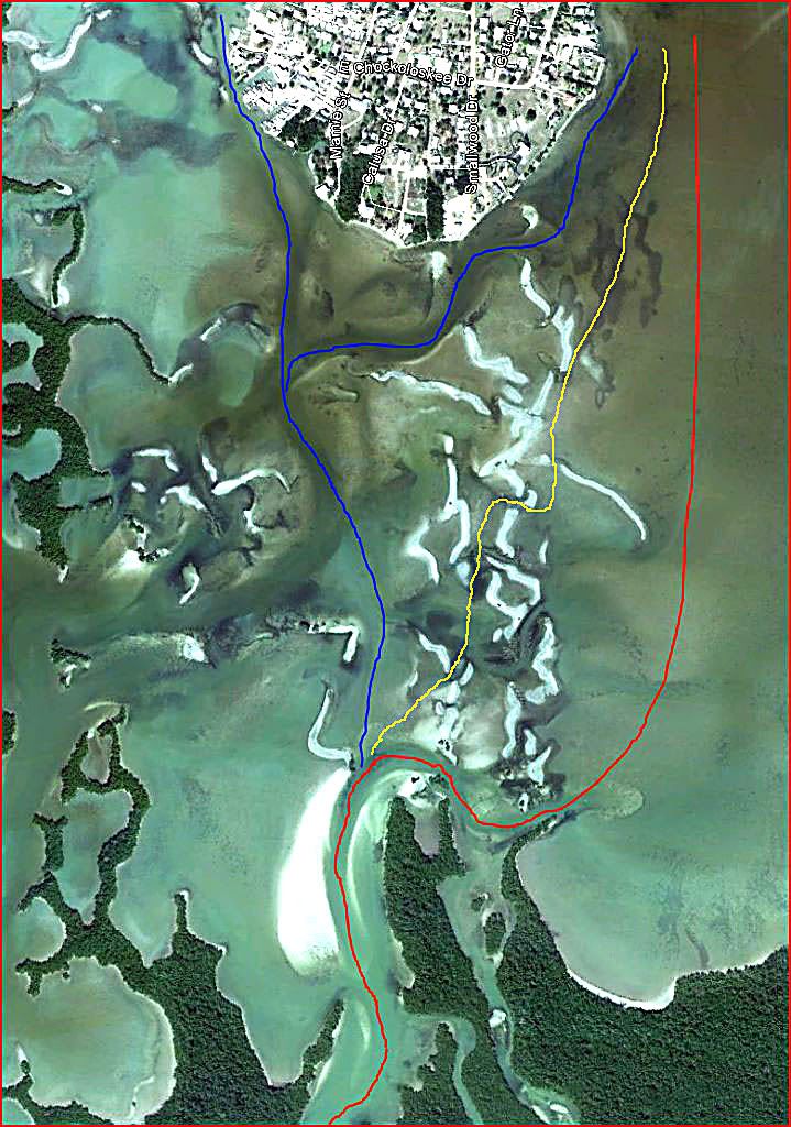
 Google Earth image of the oyster bars of Chok Bay. Can you see the channels?
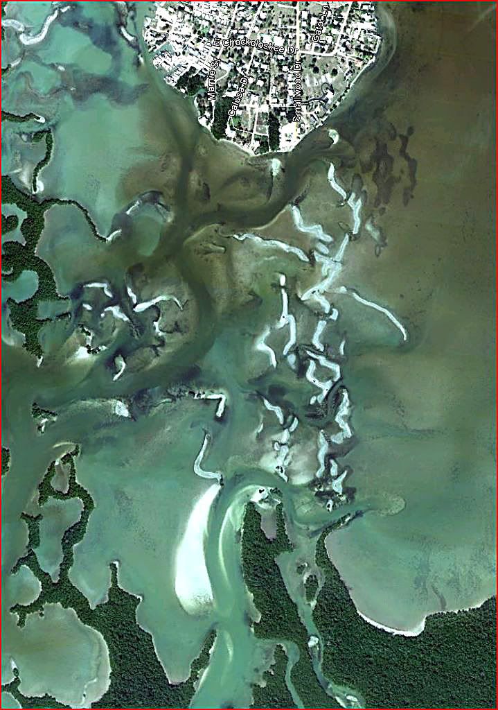 My routes through the area.
 The red line is my preferred AI/TI route because I launch/land from that side of Chok Island. The blue lines are alternatives. The yellow line is the one I like to take in my sea kayak. I love to “run” the oyster bars. Of course, at water level in a sea kayak, one cannot see that yellow route, so you muddle through as best you can. I am a “straight-line” kayaker. I don’t like to waste the time/energy doing the red or blue routes.
 Oyster bars.
 It is not low tide. At normal high tide, most of these oyster bars hide just under the surface of the water.

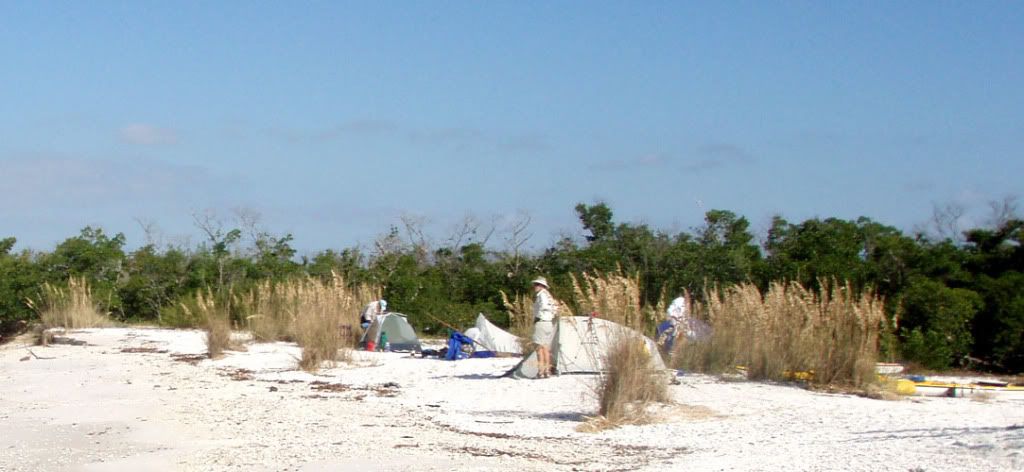
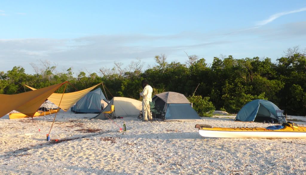
I hope you have enjoyed the trip from Chokoloskee Island through the pass to Pavilion Key. Pavilion Key is the “Crown Jewel” of the Everglades National Park. You should visit some time.
Keith